Thank you for visiting our website today. Many of you will notice that we have taken some time to refresh our website including adding a translation tool and accessibility software to enable everyone to learn and understand more about the development and what will be happening, as we start the journey towards construction.
Outline Planning Permission was granted on the 11th September 2023 for up to 1,200 homes including affordable housing, a primary school, local centre and public open space on the Land East of Highwood Quarry (LEHQ) site which is located within the Easton Park Estate. For reference: (Outline Planning Reference UTT/21/1708/OP & Appeal Reference: APP/C1570/W/21/3289775).
You can find out more or remind yourself of the development that was granted Outline Planning Permission in September 2023 and will be built on the site over the coming years.
As we progress with the pre-commencement conditions and work towards the first Reserved Matters planning application, we will update this website with all the relevant information to make sure you know what is happening.
If you would like to receive updates directly, please take a couple of minutes to register with us.
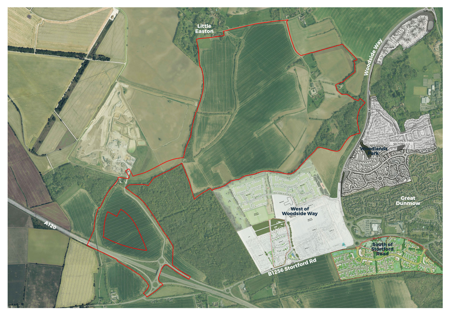
The site covers 149 hectares of land to the west of Great Dunmow and to the south of Little Easton. The site is a walkable distance from Great Dunmow High Street along with other key amenities including the Tesco supermarket on Stortford Road. It is in close proximity to Stansted Airport, which is the largest employer in the area and major contributor to the regional economy. Stanstead Airport railway station provides direct connections to London and Cambridge.
The A120 runs to the south of the site providing direct access to the M11 motorway, Bishops Stortford and Colchester. The site is also close to existing employment locations, schools, healthcare services and other community facilities. Directly to the south of the site is the West of Woodside Way residential scheme, which is currently being built out. It is envisaged that the scheme could link up with this development and potentially share new amenities in the future.
Site Arial Location Plan (click to enlarge)
Existing Facilities
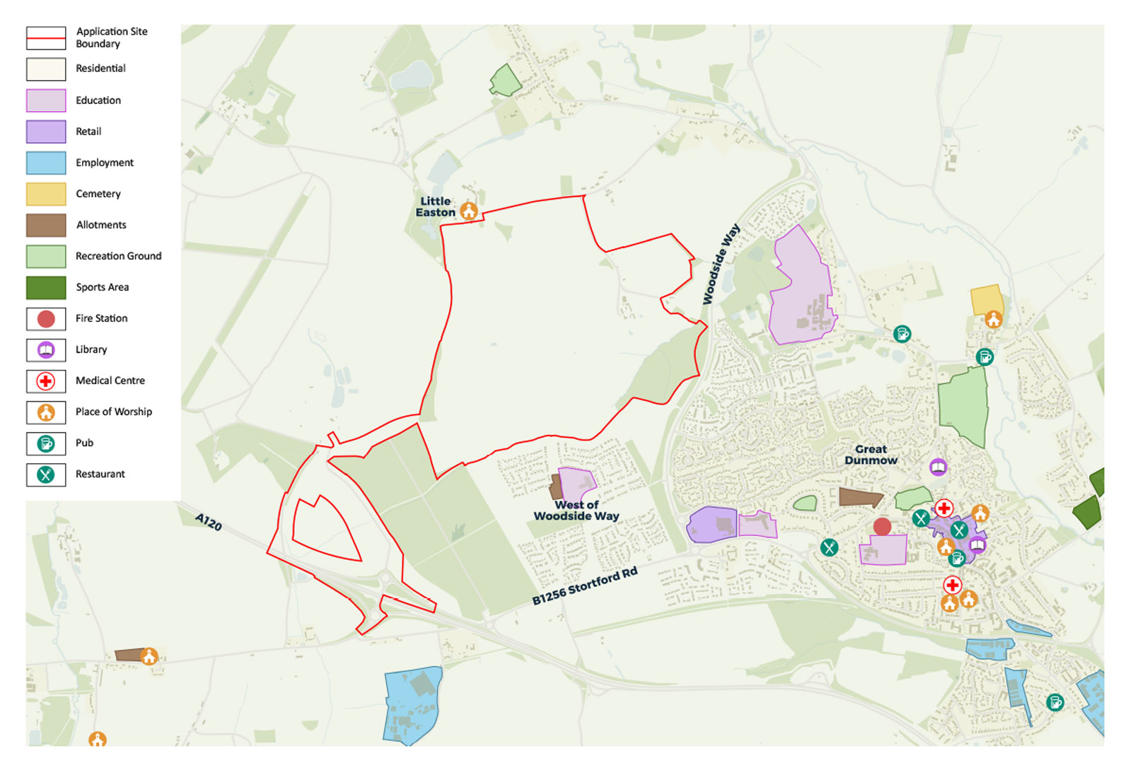
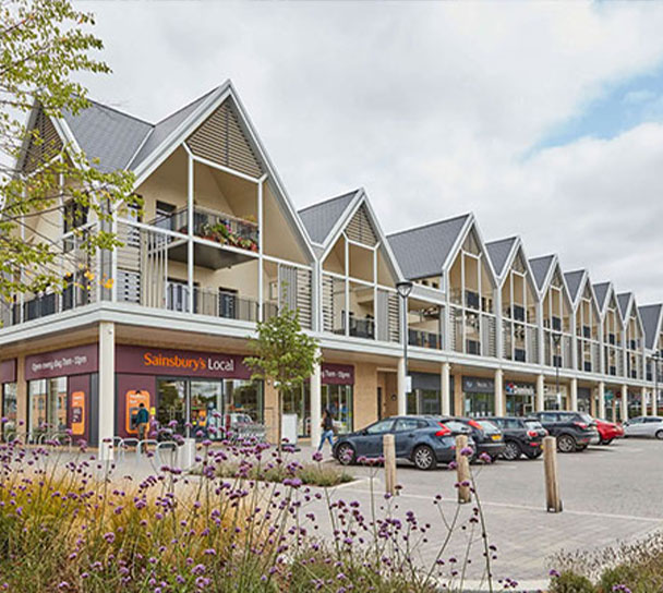
There are a mix of amenities in Great Dunmow Town Centre including retail, banks, doctors, and dentists, as well as a large Tesco to the west of the town. There are two primary schools and a secondary school (Helena Romanes School & Sixth Form Centre) in the western part of Great Dunmow. The latter is looking to expand to an All-Through School and relocate to the south of the B1256 Stortford Road.
Facilities Plan (click to enlarge)
THE DEVELOPMENT
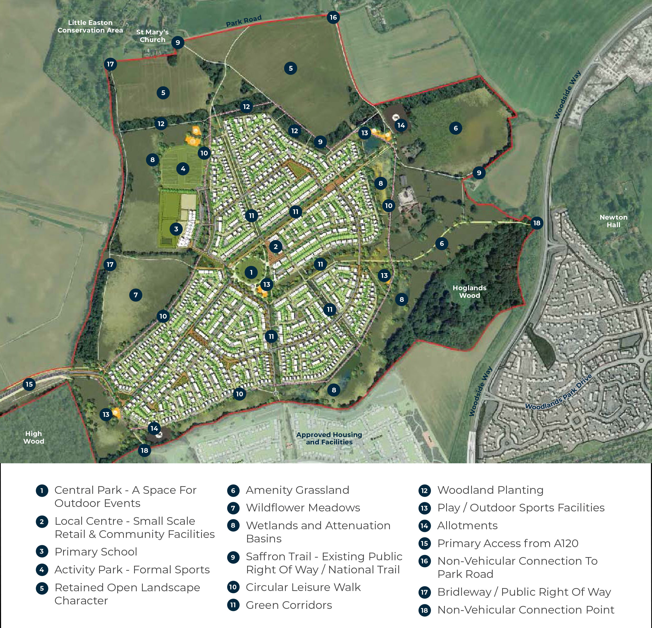
Land East of Highwood Quarry will create and provide a sustainable and attractive new community that will enhance the local area, protect the environment, and provide affordable homes for existing and future residents.
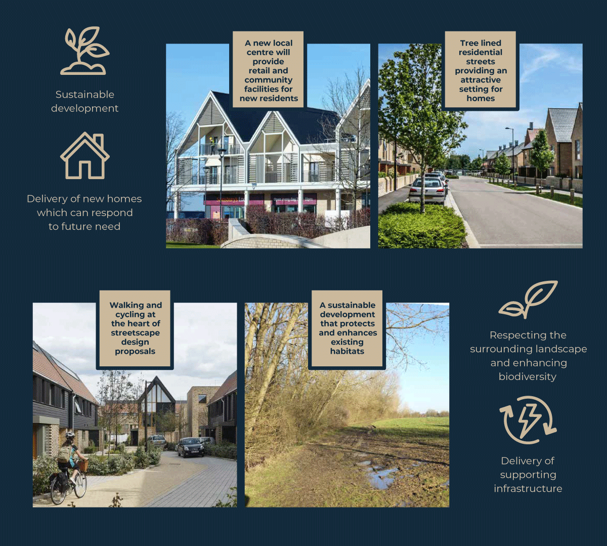
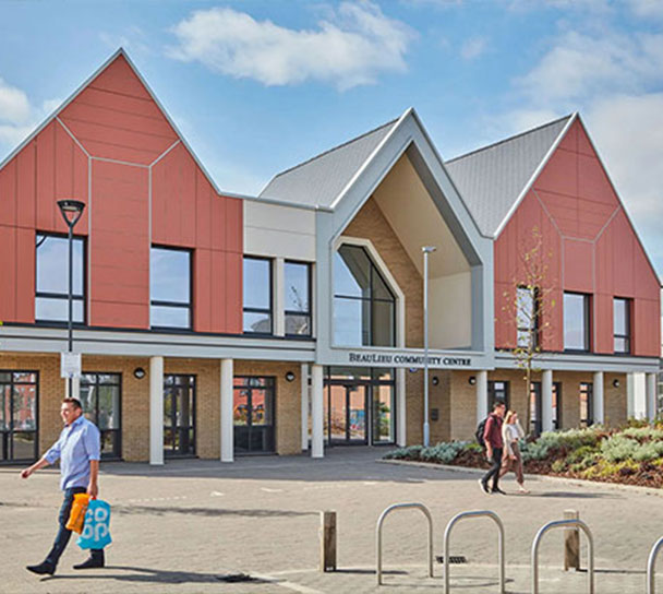
With high-quality and sustainable design principles at its heart, the development will include up to 1,200 new homes including affordable homes, a new neighbourhood centre and a primary school. Throughout the scheme we will open and link areas of previously inaccessible green space for the enjoyment of new and existing residents alike.
A range of different homes will be provided by this development, which should help not only those looking to buy their first home but also families who may be looking for increased space, or those hoping to right size. Higher density housing will be in proximity to facilities in the central area and lower density around the edges, particularly to the north of the site, where the sensitivities of the Little Easton Conservation Area and Park Road residents have been taken into consideration.
The development includes new walking and cycling routes which will connect the site with Great Dunmow and into the wider walking and cycleway network. The existing Saffron Trail, which runs across the northern part of the site, will also be maintained and improved.
Existing habitats are an important consideration in the future development of the site and, wherever possible, the site’s hedgerows, trees, ancient woodland, ponds, and habitats will be retained and protected as part of the development.
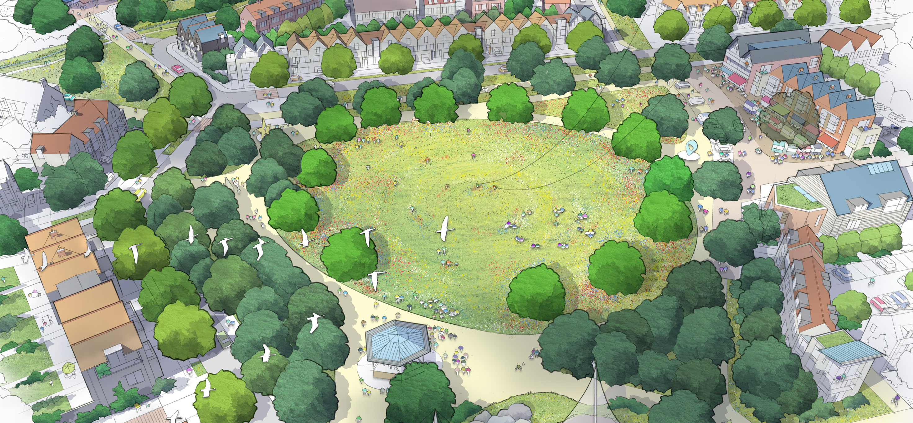
Masterplan consented on 11th September 2023 (click to enlarge)
Connectivity
The site will deliver infrastructure to support the anticipated growth in ownership of electric vehicles. Provision will be made for EV charging, both overnight within homes and including fast charging points. The power provision for the site will be sized accordingly in light of the dramatic changes in EV usage envisaged in the next ten years.
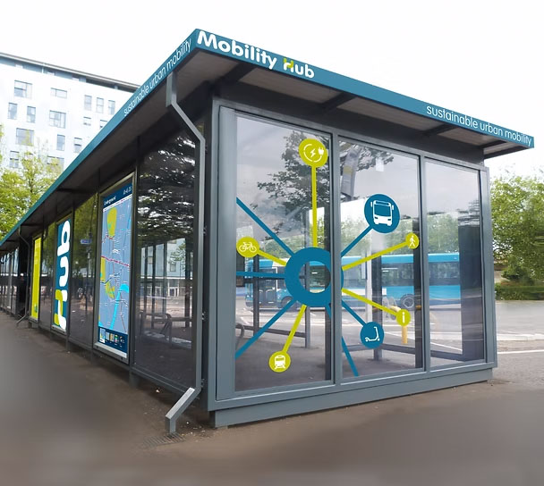
A mobility hub will be located within the local centre. Mobility hubs are places of connectivity, where different modes of transport come together i.e. walking, lift sharing, car clubs and public transport. The hubs work well in central locations connecting residents, employees, and visitors with the rest of the development.
Usable, safe, and well-lit walking and cycle routes will be provided throughout the development to maximise permeability and encourage active travel and promote a healthy sustainable lifestyle. Pedestrian and cycle routes will be given priority over motor vehicles at crossings wherever possible. Secure, accessible, weatherproof, and well-designed cycle parking will be provided throughout the development.
The two Public Rights of Way that cross the site (the Saffron Trail and north-south bridleway) will be retained and enhanced.
Public Open Space
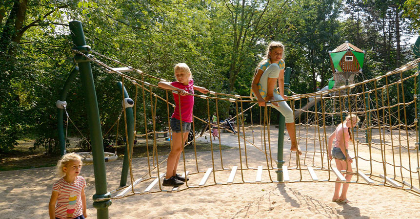
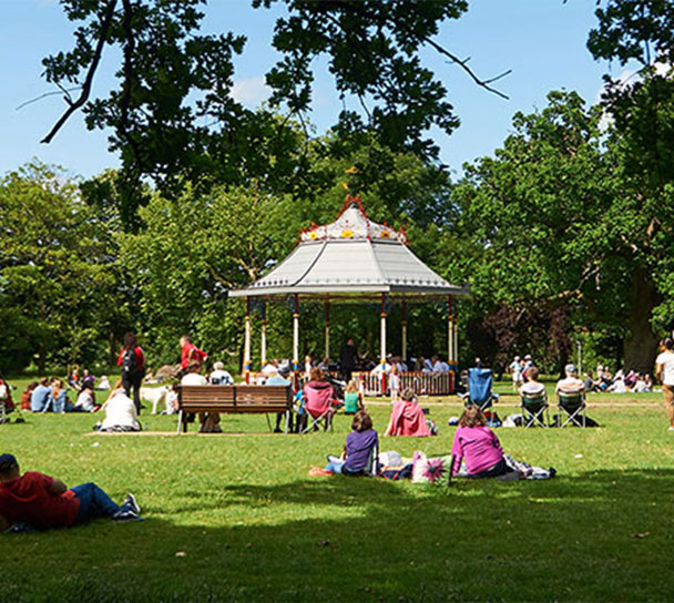
A green & healthy community which residents, visitors and the surrounding existing communities will be able to socialise, play and relax in. The area around the new homes will include enhanced ecology areas and wetlands along with wildflower meadows. These spaces will serve many different uses including play areas, sports pitches, and allotments. The existing ancient woodland on the site will be protected by a stand-off zone, likely to be formed by a border of scrub planting.
Altogether 86 hectares of publicly accessible open space will be provided, equating to 58% of the total site area excluding Hoglands Wood, High Wood and their associated buffers, and allotments.
Services
The new local centre will be at the heart of the development and will bring together the Central Park, community facilities and local shops to deliver retail and community amenities. Direct walking and cycling links provide safe access to the local centre as well as the mobility hub serving the development.
Next Steps
As part of the Planning approval granted in September 2023 and before any detailed layout plans can be submitted for approval to start building new homes, Landsec and their team of consultants must submit a Site Wide Phasing Plan to the Council. This submission will need to cover a range of defined subject areas as identified in the planning conditions and receive approval from the Council.
The consultant team has been working on this during 2024 and Landsec has now submitted this to UDC in June 2025. The condition details that must be covered in the Site Wide Masterplan and require submission to Uttlesford District Council, as the Local Planning Authority include:
Details of all open areas within the development. This includes the provision of play areas, open spaces, roads, footpaths and cycleways, sports facilities, drainage attenuation basins, allotment provision and other landscape elements.
Details of the phasing of the development including the residential areas, landscape areas, commercial, community and education facilities, and other infrastructure delivery.
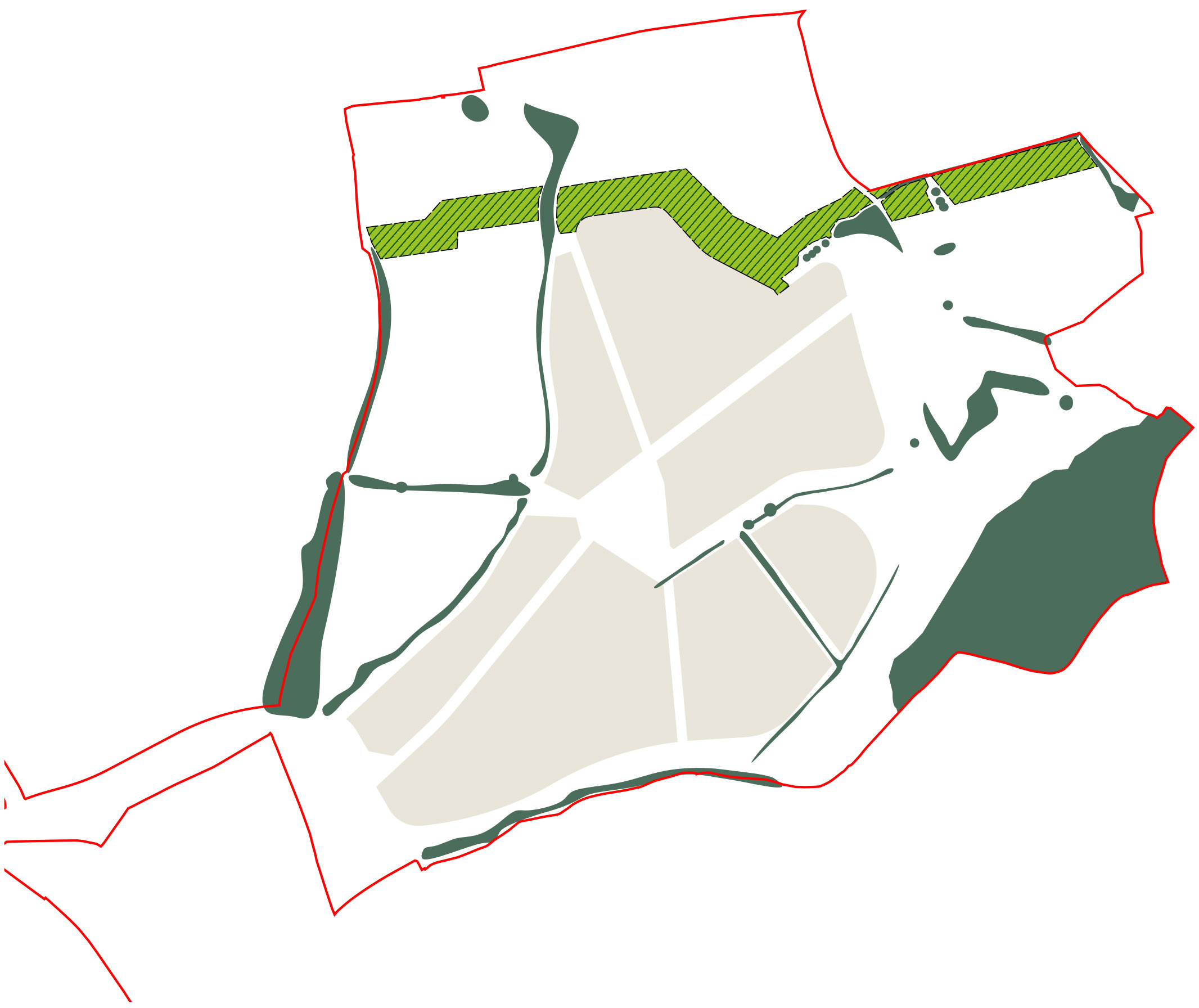
Details of the proposed woodland buffer along the northern boundary of the site.
Details of the relationships / links between the development and neighbouring uses. This could include confirmation of the footpath and cycleway connections towards Great Dunmow and the new housing and secondary school being constructed to the south of the development site.
Details of recreation opportunities and connections through the site.
Details of public transport provision and the proposed mobility hub being planned for the development.
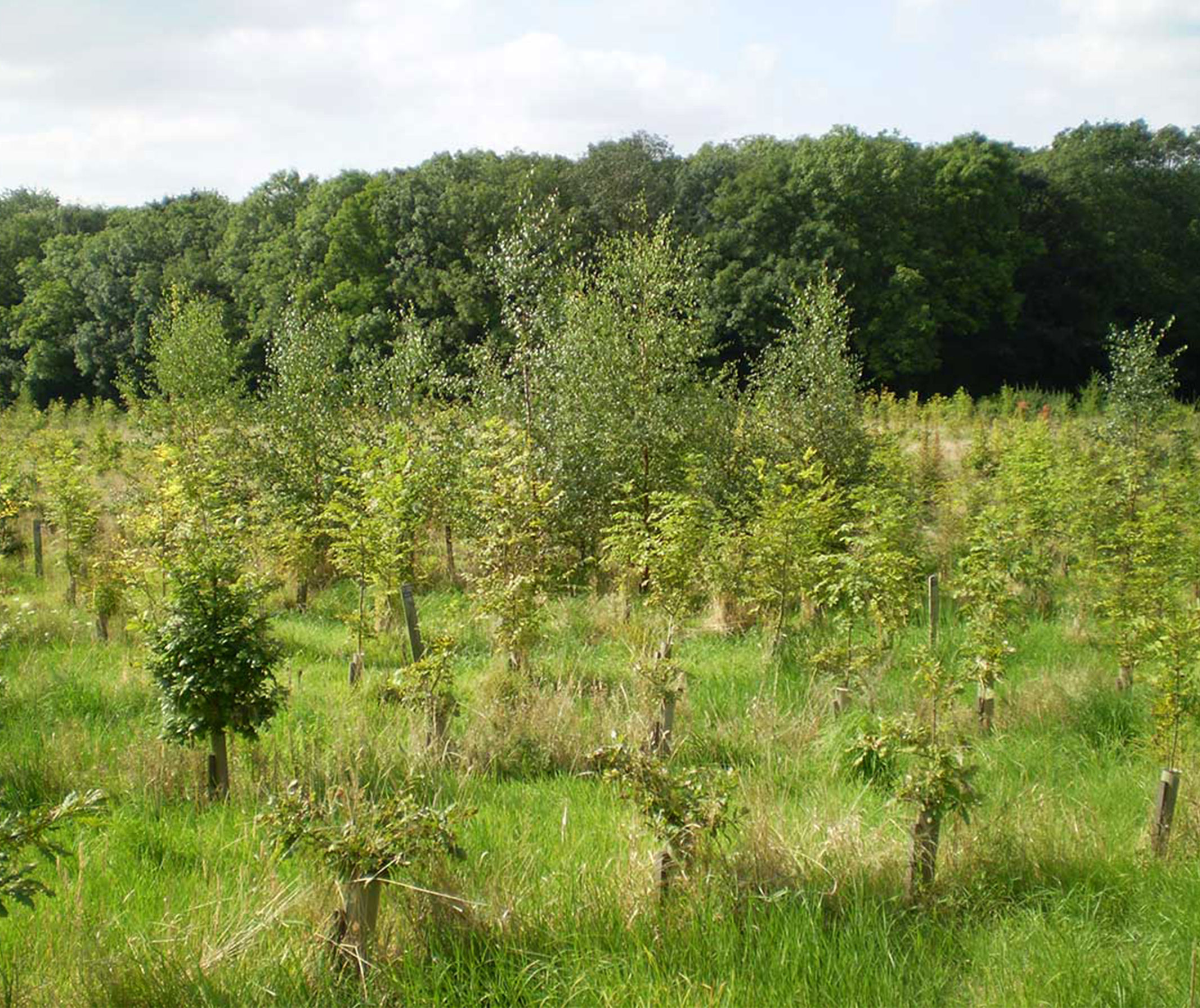
The first detailed Reserved Matters application that we have recently submitted (reference number UTT/25/1609/DFO), is not for the construction of any houses, but for the new woodland landscape buffer that is planned to stretch across the site from east to west along the northern edges of the fields to the south of Park Road. The new woodland planting will, of course, take time to grow and mature but it will ultimately reduce the visual impact of the new development when viewed from the north along Park Road and from Little Easton. The route of the Saffron Trail will also be safeguarded as part of this application.
Location of planting areaIllustrative image of planting scheme
Timeline
These timings are for guidance purposes only and may be subject to change.
September 2023 Outline Planning Permission granted
January 2024 – March 2025Preparation of Site Wide Masterplan and Reserved Matters application.
June 2025 Submission of Site Wide Masterplan and Reserved Matters application for new woodland landscape buffer to the south of Park Road, Little Easton.
Summer 2025 Anticipated approval of Site Wide Masterplan Reserved Matters Application by Uttlesford District Council.
FAQS
As with any new development there are often questions raised by the community.
The Local Centre would be a focal point for the new community and would be located centrally within the development. The exact composition of the local centre will be determined at the Reserved Matters stage, but it is envisaged as a combination of space for circulation and social gathering.
It is anticipated that there would be provision of a small range of facilities, of a local nature, which would generally meet the day-to-day needs of the community. Such facilities could include shops, cafes, small workspaces, a community centre etc.
We understand that part of the site is used during this annual event, which is subject to a separate arrangement with Landsec. The proposed development would not prevent the event taking place.
There are no proposals to redevelop the existing farm buildings. It is envisaged that these will be refurbished and remain in residential use.
Public rights of way such as the Saffron Trail and the bridle paths form an important part of the site and will be enhanced and maintained as part of the development.
The development also proposes key walking and cycling routes from east to west through the site, which pick up on the existing public rights of way and promote their future use.
There will be provision of EV charging points in accordance with policy, to allow for the anticipated transfer from fossil fuels to electric vehicles over the next 10 years. An electric car charging station will be considered at Reserved Matters stage.
Although deer will be unable to roam the built part of the site, they will continue to range over farmland and woodland in the local area (they currently use a wide area, including the site but also well beyond the site boundaries).
An Outline Planning Permission establishes the principle of development subject to it meeting certain parameters. The detailed design will then need to adhere to the parameters approved and be subject to separate approval at a later date (known as ‘Reserved Matters’). Uttlesford District Council, as the planning authority will therefore maintain control over any subsequent detailed Reserved Matters applications.
The Outline Planning Permission is accompanied by a Section 106 (S106) agreement which sets specific obligations relating to the development of the site. A S106 agreement is a legally binding agreement between a local planning authority and a developer, made under Section 106 of the Town and Country Planning Act 1990. These agreements are also known as planning obligations. These obligations ensure that the development is acceptable in planning terms and benefits the local area.
The Outline Planning Permission is subject to a number of planning conditions, which set requirements that the developer must either comply with during the course of the development or on completion of development or require the submission of additional details for approval at certain stages of the development. These conditions are designed to ensure that the development is regulated and carried out in a way that is acceptable in planning terms. For example, these may specify the length of time permission is granted for or the necessary assessments which accompany an application.
The first detailed Reserved Matters application that will be submitted will not be for the construction of any houses, but for the new woodland landscape buffer that is planned to stretch across the site from east to west along the northern edges of the fields to the south of Park Road. The new woodland planting will, of course, take time to grow and mature but it will ultimately reduce the visual impact of the new development when viewed from the north along Park Road and from Little Easton. Accommodating the route of The Saffron Trail and designing it through the new woodland will be part of this application.
We envisage the construction period for the overall development will be about 8-10 years. This will follow the granting of Outline and Reserved Matters consents and the discharge of any pre-commencement conditions.
Thank you for taking the time to visit our website today. If you have any questions or are having difficulty accessing any of the information, please do not hesitate to contact us and we will be happy to help.
If you want to chat to someone, give us a call:07909 735417 (from 9.30am to 5.00pm, Mon-Fri)
Send us an email and we will get back to you as soon as we can:LEHQ@Stantec.com
We have also submitted a Reserved Matters application for the strategic landscape buffer pursuant to Condition 1 of Outline Planning Permission UTT/21/1708/OP for the strategic landscape buffer and partial discharge of Conditions 5 and 8 in relation to the strategic landscape buffer area only. To view this application please click on the link: https://publicaccess.uttlesford.gov.uk/online-applications/search.do?action=simple&searchType=Application and use the reference number UTT/25/1609/DFO.
We take data protection seriously. Please only provide your personal details if you are willing for them to be used by Barton Willmore and the project team for the purpose of research in connection with this project and in order to update you on the progress of the project. Your details will be treated as confidential and will not be shared, passed on or used by any third parties and they will only be retained until the end of the planning process for the project, after which time they will be deleted. If you wish to withdraw consent to the processing of your personal data you may do so by emailing: LEHQ@Stantec.com
We take data protection seriously. Please only provide your personal details if you are willing for them to be used by Barton Willmore and the project team for the purpose of research in connection with this project and in order to update you on the progress of the project. Your details will be treated as confidential and will not be shared, passed on or used by any third parties and they will only be retained until the end of the planning process for the project, after which time they will be deleted. If you wish to withdraw consent to the processing of your personal data you may do so by emailing: LEHQ@Stantec.com